The Geosciences group is taking a field trip to the Flint River on Saturday, May 4th in search of conodonts.
What Are Conodonts?
 Conodonts are almost microscopic fossils, dating back 540 million years and persisting through the Triassic before becoming extinct. Their development was rapid (geologically speaking), and they are found world-wide, whereby they serve as excellent index fossils, used to identify and date various geologic rock layers. But what were they? Fish? Worms? Something otherwise unknown? Conodonts are the only body part that was preserved, being made of hydroxy-apatite, i.e. calcium phosphate, the same minerals that make up most animals’ teeth and bones.
In very recent years, body impressions were found in several locations around the world in very fine-grained silts, and conodonts are now known to be teeth from tiny jawless fish, some only a quarter inch long.
Why Flint River?
Conodonts are found in abundance in Chattanooga Shale, which happens to line the bottom of Flint River in Madison County. We have an opportunity to visit a public access site adjacent to a wide and shallow point on the river to look for these amazing fossils.
What to Expect
The water is a bit swift so careful placement of feet will be prudent, but if you fall you won’t get washed away, just very wet. You may want to wear shorts and water shoes, or at least bring a change of clothes. The water is cold. Knee boots can work but may get flooded.
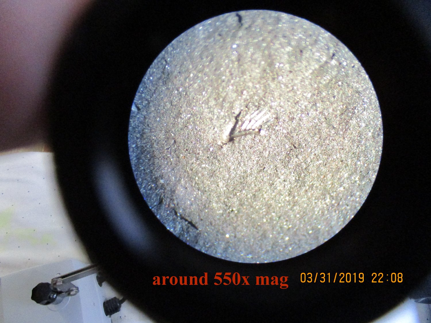 Bring a rock hammer and chisel to split the shale layers. Most of the teeth are less than a millimeter in size, some only 0.2 mm, but they are snow white, embedded in coal black rock, so a sharp eye will easily pick them out. Bring a pocket magnifier 5x or more anyway to be sure. If you do see one, check the opposite just-split-off side in case pieces have stuck to both halves. I’ll have a stand with 2”x4” boards laid edgewise to prop up the slabs while you split them. Bring a 5 gallon bucket and some newspaper to wrap specimens in to protect them. I’d suggest you plan to carry some home for later processing. We will be able to make some level of identification on the spot.
Rains will likely raise the river beyond safe levels, and it takes several days for the water to recede back to where this trip is practical. So barring any more heavy rains before May 4th, conditions should be excellent for some great hunting. If we do get more heavy rain closer in, the trip will be postponed to a later date.
You can check the current water level of the Flint River at https://waterdata.usgs.gov/al/nwis/uv/?site_no=03575100&PARAmeter_cd=00065,00060. Scroll down to the “Gauge height, feet” chart.
Directions
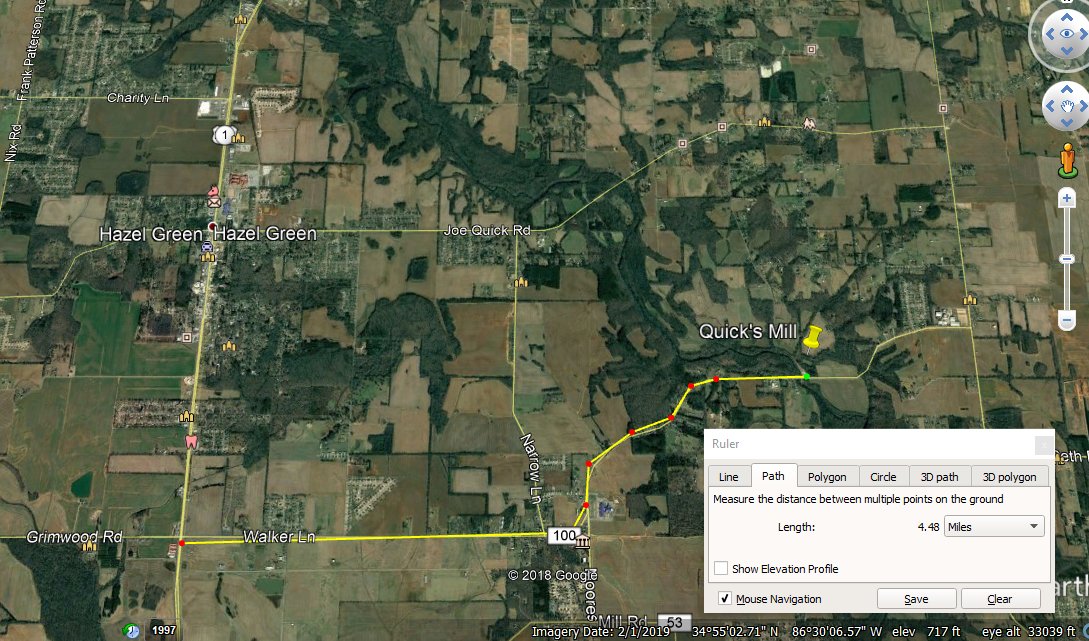
From Hwy 231/431 (north Parkway) between Meridianville and Hazel Green, take Walker Lane to the east 4.5 miles. Just after crossing Flint River, turn left on Billy Harbin Rd and immediately into the parking lot. Aerial maps are attached, with GPS coordinates. Plan to meet at 9:00am, Saturday, May 4th. An RSVP isn’t necessary, as there is plenty of room for all, both for parking and wading.

Quick Airplane Museum
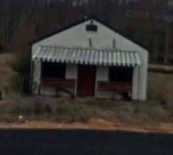
As a side treat, just on the west side of the river on Walker Lane is a small museum dedicated to the Quick Airplane, developed and flown by Raymond Quick a few years ahead of the more famous flight by the Wright Brothers in North Carolina. (A copy of this earliest mode of flight is hanging from the ceiling of the Davidson Center at the Space and Rocket Center, above the lower floor east entrance.) Also adjacent to the museum on the flume stream paralleling the Flint River is the dam that served the Quick’s Grist Mill. The mill is long gone, but the site is still interesting. Perhaps a future program on old mills in the area would be of interest.

 Did You Know?

